top of page

Sharing our memories of Heald Green
Last Updated 10th July 2026
Top
It's Not the Destination, It's the Journey

By Colin Barnsley

First Published 02/02/2022
Last Updated 28/02/2026
How a century of planning proposals has led to the transport, housing and road system we have around Heald Green today

Fig. 1a A555 Manchester Airport Eastern Link Road, under construction 2018
© Wikipedia
Click Image to View
1. Transport before the 20th Century
Beginnngs
Before we look specifically at the development of our local roads, I'd like to consider the general reasons why people live where they do. It helps us answer why, up to the early 1900s, there were still less than 50 people in Heald Green and less than 150 in the Long Lane area . It also might help inform what is likely to happen to Heald Green in the coming years.
Before machine transport, we were limited to living somewhere where we could walk (or at best and if we could afford one, ride a horse) to access the things we needed every day. Water to drink, food to eat, a job and a house to return to and be warm and dry. If we didn't farm food on our own land for ourselves, we had to get a job in walking distance to pay for the things we didn't have time to make or gather ourselves. If we had money (and time) we could pay people who made other goods and services either to bring them to us, or we could go to them and buy them. That requires transportation and jobs; to free us all to do more than collect water or grow food, and automation to make more goods and services with fewer people.
If you think of larger towns and cities, they nearly always start out around a large river. Back in the 18th Century, larger villages and towns could use sail boats and barges pulled by horses on rivers or artificial canals, to transport people and goods. They employed water-wheels to help grind flour and weave cloth for example.
Styal (Quarry Bank) Mill opened in 1784 . The mill used water from the River Bollin to turn a water wheel. That in turn moved cogs and belts to power the looms to spin cotton and make cloth. Even there in the summer, the flow of water in the River Bollin was insufficient to power the wheel and work stopped. During the Industrial Revolution in 1810, Styal Mill had a new invention fitted - a steam engine - to help power the wheel. This could do the work of around 200 people .
1
2
3
4


Fig. 1b Styal Mill 2021
© Colin Barnsley
Click Image to View
Fig. 1c Waterwheel at Styal Mill
© Colin Barnsley
Click Image to Watch a Video
Unfortunately, Heald Green didn't have access to similar large quantities of water. Heald Green's development before the 20th century was hampered by the lack of a river or other good quality transport links. Jobs were limited to working their own land, local farms and some manual weaving in cottages like those in Daisy Bank Lane. Census returns of the time show one of the cottages as housing several people engaged in handloom weaving of cotton . With manual looms and little transport, local weaving could only support the livelihoods of a few families.
Weaving may explain the origin of Heald Green's name. Spellings varied but a "kell", “yell”, “yeld” or “heald” is the device that lifts and lower threads on a loom (so a shuttle can pass through with a perpendicular thread) . Early maps refer to Kell or Heald Green . The name is definitely not derived from Heald’s Dairy (which was a family from Didsbury who didn’t have a depot in Heald Green until the 1950s!)
5
6
7
8

Fig. 1d 1841 Tithe Map. Black Brook runs to the right of Outwood Road, passed Tanyard and Bark Mill
Tithe Map of Heald Green 1841.
Researched by Frank Mitchell, drawn by Teretta Mitchell in 1976
© St. James Church, Gatley
Click On Link To View Full Map
One stream we had was known as Black Brook. It runs along Outwood Road crossing Finney Lane at the fingerpost sign and under what is in 2022, Ian Morris' butchers. Further north, it ran passed Waterfall Farm (currently Gatley Golf Club), to join the River Mersey. An open-air tanyard tanned leather, using cows from Hope Farm and sourced water for the process from the brook. It's possible the name of the brook and pond further north derived from the colour of the waste water from the tanning process. It still runs today under the houses of Outwood Road and causes occasional flooding problems .
Another stream ran under the Griffin pub, keeping their beer cool in the cellar. A third lies on our eastern border and feeds into Micker Brook and the Mersey. It still flows in a drain under the A34 bypass, and openly by the side of the path from Etchells Road leading to Sainsbury's and John Lewis car parks, for example. All were too small for transport of goods in boats or barges.
Though never a formal political boundary “Long Lane” was an area along the now B5358 Wilmslow Road (former A34). It ran from the top of Schools Hill where the road bent sharply to the right to continue to Cheadle (a turnpike at the bottom of the hill) and south to the Waggon & Horses pub and the Hurlbote turnpike at the other end . Long Lane was part of the main road to London right up to the advent of the motorways, and became increasingly busy with traffic. You can read a little more about the road in our articles on Griffin Farm and the Griffin Pub.
Cheadle Royal was developed from the mid-1840s. The first patients and staff would have travelled to Cheadle train station and then taken carriages along Long Lane to the property (named for Cheadle not Heald Green as we had no train station back then). It had a great impact on and increased the population in the area through the purchase of farms, and building new or renting of existing houses and cottages in Heald Green for patients and workers .

9
10
Fig. 1e Long Lane c1815
© United Reformed Church
from Long Lane Cheadle Remembered - K and JT Williams 1998
Click Image to View

Fig. 1f Re-assembled high quality image of Mr. John Ambrose, taking grain to market in Bollington by horse and cart.
© Graham Gill
Click Image to View
A picture from 1902 illustrates our ongoing local transport limitations. Here, Mr. John Ambrose is taking grain from his farm based at the junction of Finney Lane and Wilmslow Road (Long Lane) to a market in Bollington - by horse and cart. The newer brickwork on the side of the building suggests he had ceased to use the mill that was originally here .
Bollington is ten miles away. It's a long way to travel on poor quality roads such as these ; it will probably take all day there and back. Note how muddy Finney Lane looks, and the small garden to the front of the property (which becomes relevant later in the story).
11
Railway
2. The Coming of the Railway

Fig. 2a Heald Green Railway Station shortly after opening in 1909
From a postcard sent in 1909
Click Image to View

Fig. 2b The Styal Line 2021
© wikipedia
Click Image to View
It wasn't until 1909, that a train arrived at our very own railway station on the new Styal line . The London & North Western Railway company were concerned about the potential for flooding and delays on their West Coast Main Line (Glasgow to London via Manchester), so decided to create a contingency route to bypass the Manchester to Stockport stretch. Wooden stations and platforms were constructed along it, without much regard for their immediate profitability.
To read more about the construction of the Styal line click here.
In the end, the line was never used in earnest for London trains, but it was the making of Heald Green as it triggered our first wave of population growth. People could now live in the fresh air of the countryside but commute to central Manchester in 20 minutes. People, goods and services could be brought by train to Heald Green from all over the UK - we were at last, connected.
Housing and shops began to grow up around the station. You can read memories of some of our early 20th Century residents who recall the development of houses, roads, shops and businesses in Heald Green in our museum's Biographies and Memories section.
12
WWI-WWII
3. From Slums to Suburbs - the Inter-War Years
At the end of World War I (and again at the end of World War II), concerns about the impact of a lack of planning for population growth led to a series of proposals for Manchester and North Cheshire. Though influenced by the political aspirations of their authors and commissioners, these reports have formed the basis for future expansion out of the slums of Manchester and into the suburbs, for the last century. The actual solutions proposed may differ from those actually implemented ; the timescales to achieve them much much longer than their author's expectations! It may have taken almost 100 years but the bulk of the proposals seem to have been implemented. I would judge no major recommendations remain outstanding. There is a marvellous overview page of all these Manchester Plans covering 1926 - 1967 .
The key themes were:-
-
Population density and living conditions in central Manchester were poor and cramped
-
Housing, shopping and civic amenities should be built in new suburbs to disperse the growing population more widely
-
Planning should divide the city into zones (residential, industrial etc) which would also improve health / access
-
New and improved roads and other transport links should be introduced.
The 1926 Regional Scheme sets the scene and is worthy of examination for making a start ; but it is really after WWII that the proposals begin to impact on Heald Green, in the 1945 City of Manchester Plan. . This second document also better describes the pre-WWII development history for us.
13
14
15

Fig. 3a City of Manchester Plan 1945
© Manchester City Council
Click Image to View
The Acquisition of Wythenshawe
The 1945 report states, "By 1918 the Manchester Corporation had recognised a need for land on which to build a great many new homes to help cope with overcrowding in central Manchester. The corporation opened tentative negotiations for "the purchase of a substantial tract of farmland in the rural district of Bucklow, forming part of what is now the Wythenshawe Estate. This land had belonged to the Tatton family since the fourteenth century." This land forms the western border of Heald Green ; the Tatton Arms pub is so named for the original owners of that land, for instance.
"In 1926 Manchester purchased the land and in the same year Sir Ernest and Lady Simon generously presented Wythenshawe Hall, with its surrounding park of 250 acres, to the corporation." The total land procured through these and other purchases came to over 4,000 acres.
16
New Roads - Princess Road and Kingsway
In 1919 some 350,000 cars were using the country's roads ; by 1938 that had risen to 3.1M . The plan proposed two important roads south of Manchester, which were constructed pre WWII .
Wikipedia states of Princess Road (A5103), "The original scheme for a new road through the rural area south of Manchester was the design of the urban planner Richard Barry Parker, who envisaged the creation of a parkway – a broad, landscaped highway – to run from the new garden suburb of Wythenshawe, connecting it with Manchester City Centre. Manchester Corporation began construction of the new Princess Parkway in 1929 with a new bridge over the River Mersey. The new road was laid out as a dual carriageway for motor vehicles with a segregated tram track along the central reservation for Manchester Corporation Tramways to run trams into Manchester City Centre."
19
17
18
20
Kingsway, named for George V, was seen as a relief road for southbound traffic using the existing Wilmslow Road, which runs through Fallowfield, Withington, Didsbury and over to Parrs Wood. Kingsway ran from Fallowfield, through Ladybarn, Burnage and stopped before the Mersey in Parrs Wood. It was built in stages from the mid 1920s and those original plans completed in 1930. Like Princess Road it had a central reservation reserved for tram lines - these were removed in 1949 when the Tramways ceased operation . This historical tram terminus meant Parrs Wood continues even today as a terminus for southbound Manchester buses. On a personal note, even though the 1945 Manchester Plan considered North Cheshire, later boundary changes in 1974 gradually meant less integration of services and this became the end of the line for many buses - and a long walk home for me!

Fig. 3b Didsbury / Wilmslow Road meets Kingsway at Parrs Wood; note tram bottom right above flare 1929
© Britain From Above
Click Image to View
Now, you may be wondering why I've illustrated what was happening in Manchester rather than concentrate on impacts to Heald Green; after all, no-one was building new or widened roads yet here. The reason is, these new roads, the thinking behind them and extra cars did begin to impact us, with additional traffic along Long Lane. Moss' Cafe on Wilmslow Road opposite Outwood Road, (the house demolished when the site became first Quick's Garage and today, the Southgate Centre) and the Caravan Cafe (made from an old railway carriage), providing teas and snacks to passing drivers. As this was the main road to London, the facilities were used by many lorry drivers, and cyclists escaping the smog of central Manchester for a breath of our fresh, country air.
The 1945 plan recognised unexpected consequences of their attempts to provide wider Manchester roads. As planning was not controlled effectively along them at first, shops built up close to their edges. This led to kerbside parking and pedestrians crossing, both slowing the flow of traffic. They concluded post-WWII plans must divert shops from highways to safer, pedestrianised shopping centres, and offer multi-storey car parking to take the vehicles away from kerbsides . What happened on Princess Road and Kingsway influenced the post-WWII infrastructure that was built around Heald Green.
17

Fig. 3c Moss' Cafe on Wilmslow Road (Long Lane), c 1930
© Ratepayers' Association
Click Image to View

Fig. 3d Caravan Cafe on Wilmslow Road (Long Lane), c 1930
© Ratepayers' Association
Click Image to View
Manchester Airport
The other pre-WWII addition to nearby transport infrastructure was Manchester Airport. The 1945 plan discusses how various sites were considered but one in the parish of Ringway was chosen (hence its original name). The existing site at Barton was inadequate in terms of size, meterological conditions and the type of ground (the clay at Ringway meant a better runway surface as water tends to pool on the surface rather than soak in and create mud like at Barton) .
Manchester Airport opened in 1938. During WWII, there were 4 grass runways at Ringway. 3 of the 4 were replaced with concrete in 1945 . I wonder if this configuration influenced the Airport's thinking in campaigning for 3 runway solutions for many years? Though we seem to have settled on 2 runways - for now.
18,8
21
22

Fig. 3e Manchester Airport in 1938
© Manchester Evening News
Click Image to View
WWII-60s
4. Post World War II - 1960s
Kingsway Extension and Milk-Can Corner
In 1959, Kingsway was extended south across the Mersey to bypass Cheadle, and re-labelled as the A34 in 1967 . A short extra spur was added to the top of Schools Hill to join at a T-junction with the new road (you can see a lorry turning into it on a picture below) ; it was more or less there anyway, as the entrance road to Highfield House (demolished). The original sharp southward bend at the start of Long Lane became a layby. It more or less follows the course of the slip road from the now Cheadle Royal roundabout, as you head North off it towards Cheadle. The new Kingsway then joined to the existing Wilmslow Road (Long Lane), roughly at the Cheadle Royal exit slip-road as you come South towards Sainsbury's / John Lewis today.
“Milk-can corner” was where residents from the 1930s remember numerous local farmers erected trestle tables and placed churns of milk, as both a pick-up point for local delivery businesses, and with an honesty box for anyone who brought their own container / jug to get their milk. It was where Schools Hill turned sharply into Long Lane, at the entrance to Highfield House.
20

Fig. 4a Kingway Extension 1959
© Ratepayers' Association
Click Image to View
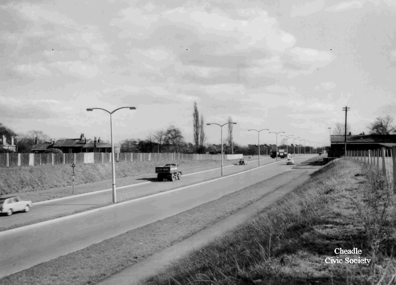
Fig. 4b Kingway Extension 1959 (with lorry turning
into new T-junction with Schools Hill)
© Ratepayers' Association
Click Image to View

Fig. 4c Kingsway Extension ; 1888 v 2020 overlaid maps ;
"x" marks the location of Milk Can Corner
© ARCHI Information Systems
Click Image to View

Fig. 4d Earlier times - Cyclists in 1900s on start of Long Lane, which then became a layby
© C. Makepeace, Cheadle & Gatley Postcards
Click Image to View
Pre 1960s Buses and trains
Peter Davies kindly contributes some history on early buses and trains :-
"... from winter 1963/4...the map opposite shows route numbers of the much lamented Northwestern Road Car Company Ltd (formed in 1923). The company covered a vast area around Manchester before it was broken up on the formation of South-East Lancashire and North-East Cheshire Passenger Transport Executive (SELNEC PTE), in the 1970s.
Routes 29,30,52. Covered Manchester-Alderley-Macclesfield with a ten minute service.
Route 180 Stockport-Heald Green, half-hourly service.
Route 64 Manchester-Styal via Heald Green Railway Station, 15 minute service.
Route 97a Altrincham Bus Station dep 7.35am - Heald Green Railway Station arr 8.00am, Mondays to Fridays
Route 79a Stockport-Heald Green Railway Station, hourly service."
Peter's British Railways Summer timetable for 1961. shows a half- hourly service (extra trains at peak) from Heald Green through to Manchester, Oxford Road timed at twenty minutes. Today's timetable allows 21 minutes! Sunday service was hourly.

Fig. 4i North Western Bus Map 1963/4
© NW Road Car Co Ltd, courtesy of Peter Davies
Click Image to View
1962 SELNEC Highway Plan
In 1958 South-East Lancashire and North-East Cheshire (SELNEC) Highways Engineering Committee was commissioned by the Ministry of Transport to form a long-term transport plan . The resulting 1962 report shows costed solutions to transport in and around Heald Green and something - if not exactly what was written down - has by today been implemented for all of it - a lot slower than I think they were expecting at the time. The most salient proposals were:-
-
No. 418 - the widening of B5166 Styal Road - £200,000 ; completed around 1967
-
No. 402 Griffin Farm to Kingsway - £400,000 & No. 403 Wilmslow to Waggon & Horses bypass £800,000
-
The latter two resulted in the A34 bypass extension to Wilmslow in the 1990s; but this report influenced some local decisions much sooner (for instance, the United Reformed Church, expecting Wilmslow Road to be widened in front of it, created a new building in 1964, set further back from the road
-
Stockport East-West bypass (which became M63 but not until 1974, and then M60)
23
24
25
26

Fig. 4e SELNEC : A Highway Plan 1962
© SELNEC
Click Image to View

Fig. 4f Proposed Ring Roads (showing what later becomes M63 / 60 & M56)
© SELNEC Report 1962
Click Image to View

Fig. 4g Parrs Wood Junction 1962
© SELNEC Report 1962
Click Image to View

Fig. 4h LijnBaan Shopping Precinct, Rotterdam. The basis for Stockport Merseyway which opened in 1965, perhaps?
© SELNEC Report 1962
Click Image to View
Potholes!
At the start of the 1960s, the Ratepayers' Association took photos to accompany complaints to the builders of the new estates forming Heald Green's second growth wave. Estate roads were being left in a terrible state - full of potholes. As new builders approached the older, more westerly section of Westwood Road from the opposite direction for example, they failed to join up the two halves! Particularly bad potholes were also found in Motcombe Road and Davies Avenue - but there were many other examples.
28

Fig. 4j Westwood Road's two halves didn't meet! 1960
© Ratepayers' Association
Click Image to View


Fig. 4k Potholes, Motcombe Road 1960
© Ratepayers' Association
Click Image to View
Fig. 4l Potholes, Davies Ave near Bolshaw Road 1960
© Ratepayers' Association
Click Image to View
The very first edition of the Ratepayers' Contact Magazine in Oct 1962 reported that Brown Lane reconstruction was nearly completed . In August 1961, the Surveyor's Department based at Abney Hall had written to residents requesting the sale of part of their front gardens to create much-needed footpaths that had been absent at the time of construction.
29

Fig. 4m Adding Pavement to Brown Lane 1961
© Ratepayers' Association
Click Image to View
Styal Road
Work commenced on the diversion of Styal Road from the Wilmslow boundary to Brown Lane, in summer 1967. When complete, there were traffic lights on the new line of Styal Road / Simonsway junction and short lengths of old Styal Road north and south of the Heald Green Hotel became cul-de-sacs. The three affected stretches (from south to north) were named Cunningham Drive, Irvin Drive and Daisy Bank Lane respectively. March 1968 Contact magazine reported weather delays to works over winter of 1967/68 , but as it is never mentioned again in any later edition and we don't have other documents or maps to confirm, my best guess is the work was completed the following spring/summer, in 1968.
30
31

Fig. 4n The Heald Green Hotel and bus terminus, 1962. The picture looks towards Wythenshawe and the then T-junction of the old Styal Road & Finney Lane.
The cottage (centre) was demolished.
© Ratepayers' Association
Click Image to View
%201967%20Cheshire%20Life%20watermarked.jpg)
Fig. 4o Cottages on Daisy Bank Lane, then Styal Road, 1967
© Cheshire Life
Click On Image To View, or "Cheshire Life" to read the 1967 article

Fig. 4p The section of Styal Road replaced in 1967,
highlighted in purple (current road in orange)
© Colin Barnsley
Click On Image To View

Fig. 4q Finney Lane / Styal Road Junction 2021
© Colin Barnsley
Click On Image To View
Finney Lane / Wilmslow Road / Etchells Road Junction
With the extension of Kingsway across the Mersey and generally increasing levels of traffic, the Finney Lane / Wilmslow Road / Etchells Road junction was becoming a bottleneck, as illustrated by photos of the traffic chaos at the time. By 1967 a brand new Griffin Pub was approved and built back from Wilmslow Road to allow for car parking at the front. The site was made larger by knocking down several old buildings including a farmhouse, cottage and barn. Across Finney Lane, the gardens on the houses opposite (today the building are joined into The Courtyard offices), were removed so as to widen the road, and a new junction layout and traffic lights installed .
Unfortunately, straightening out the kink in the road between Finney Lane and Etchells Road never took place. Whilst I have absolutely no firm evidence, some residents joke that this was because a local councillor's mother lived in one of the corner cottages! But more likely, the compulsory purchases necessary would have made the cost prohibitive .
In December 1967's Contact magazine, implementation of a new junction was under consideration . We're not certain precisely when work was complete, but by the Summer 1969 edition, the junction had been redesigned and residents were "watching the effects" ; the speed limit along Kingsway to this junction was set at 50mph .
32
33
34
35

Fig. 4r The old Griffin Pub and nearby buildings at Finney Lane / Wilmslow Road Junction c 1920
Source unknown - please contact us if you have more info
Click Image to View

Fig. 4s Traffic Mayhem 1965
© Graham Gill
Click Image to View

Fig. 4t Traffic Mayhem 1965
© Graham Gill
Click Image to View
.jpg)
Fig. 4u Orderly traffic at the new junction
with remodelled Griffin Pub - c 1969
Source unknown - please contact us if you have more info
Click Image to View
70s-90s
5. 1970s-1990s
Motorways
Heald Green's second wave of expansion stopped at the end of the 1960s. The changes near us in the 1970s majored on the formation of motorways and ring roads.
In 1972, J3-7 of the M56 opened ; in 1974 the M63 reached as far as Stockport and in 1984 as far as the Portwood roundabout . Work to complete the entire orbital road and its reclassification to M60 just squeezed into the 20th Century - completing in 1999/2000 .
36
37
38

Fig. 5a Manchester's Motorway Network 2022
© Tameside Council
Click Image to View
SELNEC Buses
SELNEC took over the operation of buses on 1st November 1969. They did not adopt the red of the Manchester buses they inherited, but instead opted for a politically neutral orange and off-white, launched on 11th March 1970 .
I particularly recall the 368/369 (Wythenshawe Hospital to Stockport), which was one of the few buses that cut across Manchester's perimeter rather than following the radial/spoke system nearly all Manchester's transport favours (to the detriment, I think of the satellite towns on Manchester's outskirts).
Living as we did off Wilmslow Road, it was much easier for me to catch one of the green Crosville buses - E29 or E30 later 129 130, travelling from Macclesfield to central Manchester, rather than walk 20 minutes to the railway station. For most of my youth I remember there was joint operation between Manchester and Macclesfield buses on the route.
The bus service seems to have been the major casualty of growth in car ownership over the years. When my parents grew up in central Manchester they owned no car and never even thought about a bus timetable ; they turned up every few minutes. In the 1970s we did have a family car and you probably did want a timetable, as buses operated perhaps every half hour. In 2022's society of multi-car families, you can still get into Manchester on some buses about once an hour, but it appears only as far as Handforth Dean it seems, in the opposite direction.
The Manchester Transport Museum offers memories of the old bus routes, models and their liveries.
39

Fig. 5b 369 Bus - Airport to Stockport
© Mikey, Flickr
Click Image to View

Fig. 5c 130 Bus - Macclesfield to Manchester
© Andrew Critchlow, Flickr
Click Image to View


Fig. 5d 368 Bus Route 2022
© Transport for Greater Manchester
Click Image to View
Fig. 5e 130 Bus Route 2014 (no more!)
© C-Line (superceded Crosville)
Click Image to View
Planning Concerns
In 1989, the Autumn Contact Magazine ran an article expressing concerns that if the plethora of forthcoming proposals were realised, there would soon a "concrete collar" around Heald Green . With our third major growth wave - if the application for Nixon's farm housing is approved, Bloor Homes building on former Griffin Farm land and houses expected on neighbouring Gatley Golf Club and opposite Handforth Dean - this will have indeed, finally come true. There will be next to no "Green" left in "Heald Green", or around it.

Fig. 5f Contact Magazine Article re. Development Plans in Heald Green, 1989
© Ratepayers' Association
Click Image to View
More Air, More Roads
Manchester Airport's second runway opened in 1991 , further exacerbating poor traffic conditions in Heald Green. The E-W link (A555) first proposed in the 1940s, would not open and alleviate traffic levels on Finney Lane until 2018 .
A railway spur from the Styal line to Manchester Airport was opened in 1993, to accompany the opening of Terminal 2 .
41
42
.jpg)

Fig. 5h T2 construction nears completion 1991
© Manchester Airport Archive
Click Image to View
More Air, More Roads
As far back as the 1945 plan, they began to talk of Green Belt, areas of countryside as a breathing space between the outskirts of the city and the next satellite development . However, its purpose has been interpreted differently over the years. My Mum was most upset when one councillor stated back in the 1980s that he was pleased they had preserved the Green Belt land behind our house knowing the A34 bypass would eventually be built on it. This was plainly not the aspiration for fresh air and health as seen by those original planners!
The first part of the E-W link (A555) - Woodford / Bramhall to A34 bypass - opened in 1995, as did the A34 Handforth bypass to Wilmslow. In the same year, Sainsburys and John Lewis stores also opened . With the opening of the bypass, the original Long Lane / Wilmslow Road / A34 was redesignated B5358. I guess newer residents are barely aware of the name Long Lane, though thankfully preserved in the Post Office at the corner with Merwood Avenue.
All these developments probably only worsened traffic on local roads, drawing more traffic to the area. Finney Lane continued to be a bottleneck, for traffic moving to and from the airport / M56 link.
43
44
.jpg)
Fig. 5i A34 Handforth Bypass under construction. Looking South near flats on Hall Meadow 1993
© Helen Morgan
Click Image to View
.jpg)
Fig. 5j A34 Handforth Bypass under construction. Looking West along Etchells Road 1993
© Helen Morgan
Click Image to View

Fig. 5k Sainsburys and John Lewis 2009
© Wikimedia Commons
Click Image to View
21st Century
6. 21st Century
In 2008, the A555 relief road was mooted again, and money pledged by Geoff Hoon, then Secretary of State for Transport .
Some ten years later in 2018, we finally got a bypass , offering some relief to traffic on Finney Lane. Unfortunately because inadequate drainage solutions have been put in place, the A555 suffers from frequent flooding and stretches are often closed.
45
42


Fig. 6a Funding for A555 2008
© Stockport Times
Click Image to View
Ideas from earlier Manchester plans have been exhausted after almost a century. In 2017 Manchester published a new Transport Strategy covering up to 2040 . I didn't know there was one until I went looking! Were you aware?
46
Fig. 6b TfGM Strategy for 2040,
first published 2017 updated 2021
© TfGM
Click Image to View
The Road Ahead
Circumstances are changing rapidly and we need to consider what may happen when planning our future transport system. Post covid more people are working from home rather than commuting. With increased use of the internet and home delivery networks, what transport will we need in the future? What is likely to happen to the size of our population? With cleaner, electric vehicles and perhaps new forms such as delivery drones or maybe even flying cars before long, what roads will we need?
Maybe it's time for us all to have a read of this latest transport strategy, think about what we want, and have our say.

Fig. 6c A555 in 2021
© Colin Barnsley
Click Image to View
Bibliography
-
Gilligan, D. May 1988. The Making of Heald Green. North Cheshire Family Historian. 35(2), pp. 2.
-
Mitchell, K. and JT. 1998, Long Lane Cheadle Remembered. United Reformed Church, pp. 17
-
Quarry Bank Revealed, 2013, A brief history of Quarry Bank.
-
Dibnah, F (2006). Quarry Bank Mill Power. : Youtube.
-
Windross, S (2021). Daisy Bank Cottages. HG Heritage Museum: .
-
A Brief Introduction to Weaving Machine Heald Frame - Sino Textile Machinery
-
Unknown (1800). Map of Stockport AD 1800. : Ratepayers Association.
-
Morris, Ian ; Morgan, Helen ; other Heald Green residents, in conversation, 2021.
-
Mitchell, K. and JT. 1998, Long Lane Cheadle Remembered. United Reformed Church, pp. 8
-
Various (2021). Cheadle Royal. HG Heritage Museum: .
-
Makepeace, C.E (1988). Cheadle and Gatley in Old Picture Postcards. : Europese Bibliotheek
-
Styal Line - Wikipedia
-
Dodge & Brook. Forty Years of Planning the Future of Manchester: The Key Plans from 1926-1967. : .
-
Manchester City Council. Report Upon the Regional Scheme 1926. : Issuu.
-
Manchester City Council. City of Manchester Plan 1945. : Issuu.
-
Manchester City Council. City of Manchester Plan 1945. : Issuu. pp.145.
-
Manchester City Council. City of Manchester Plan 1945. : Issuu. pp.43-45.
-
Manchester City Council. City of Manchester Plan 1945. : Issuu. pp.13.
-
A5103 road - Wikipedia
-
Kingsway (A34) - Wikipedia
-
Manchester City Council. City of Manchester Plan 1945. : Issuu. pp.76.
-
Third runway may be built - Manchester Evening News
-
SELNEC (1962). A Highway Plan. : SELNEC. pp. 1
-
SELNEC (1962). A Highway Plan. : SELNEC. pp. 83
-
SELNEC (1962). A Highway Plan. : SELNEC. pp. 59-60,83
-
Haigh, Alison, in conversation, 2021.
-
SELNEC (1962). A Highway Plan. : SELNEC. pp. 57,74
-
Burns, Peter, in conversation, 2021.
-
The Editor, October 1962. HG Jottings. Contact Magazine., pp. 13
-
The Editor, September 1967. Heald Green Jottings. Contact Magazine., pp. 6
-
The Editor, March 1968. Heald Green Jottings. Contact Magazine., pp. 6
-
Various (2021). The Griffin Pub. HG Heritage Museum: .
-
Various Heald Green residents, in conversation, 2021.
-
The Editor, December 1967. Heald Green Jottings. Contact Magazine., pp. 9
-
The Editor, December 1967. Heald Green and Long Lane Jottings. Contact Magazine., pp. 10
-
M56 Motorway - Wikipedia
-
M63 Motorway - Wikipedia
-
M60 Motorway - Wikipedia
-
SELNEC Preservation Society Website
-
The Editor, Autumn 1989. Time For You To Protest. Contact Magazine., pp. 4-5
-
Various (2021). Manchester Airport. HG Heritage Museum: .
-
A555 road - Wikipedia
-
Manchester City Council. City of Manchester Plan 1945. : Issuu. pp.108-114.
-
Blatchford, J (2020). The Grand Opening of John Lewis Cheadle. : John Lewis Website.
-
Devine, P (2008). £165M Boost For A555 Relief Road. : Stockport Times West. pp.1 .
-
TfGM (2017 updated 2021). Greater Manchester Transport Strategy 2040.
Related Links
-
A555 road - Wikipedia
-
Quarry Bank | National Trust
-
Industrial Revolution - Wikipedia
-
Didsbury - Wikipedia
-
Architecture & history | St James Church, Gatley
-
About the URC | Heald Green United Reformed Church
-
London and North Western Railway - Wikipedia
-
West Coast Main Line - Wikipedia
-
Britain From Above
-
Manchester Airport pictures - Manchester Evening News
-
Wythenshawe Hall
-
The Tatton Family and Park
-
Stockport Merseyway_Shopping_Centre
-
North Western Road Car Company (1923) - Wikipedia
-
SELNEC Preservation Society
-
Crosville Timeline
-
Manchester Transport Museum
-
M63 motorway - Wikipedia
-
M60 motorway - Wikipedia
-
Abney Hall - Wikipedia
-
Transport for Greater Manchester - Wikipedia
-
Geoff Hoon - Wikipedia
Search Our Museum Library (Google Drive account users only)
Timeline
Can You Help Us Improve The Museum?
-
Do you have any related personal memories, photos or documents that you can share with us on this topic?
-
Are any of our facts incorrect?
-
Contact us at healdgreenheritage@gmail.com, or via our Heald Green Heritage Facebook Page.
bottom of page